The Comprehensive Conservation Plan (CCP) planning team drafted the following goals for the San Diego NWR based on: 1) the interim refuge goals presented in the Final Land Protection Plans for the Otay-Sweetwater Unit and the Vernal Pools Stewardship Project; 2) input provided during the scoping process for the CCP and subsequent agency and stakeholder meetings and workshops; and 3) internal Fish and Wildlife Service review.
Goal 1 - Protect and manage federally endangered and threatened species and the habitats that support such species.
Goal 2 - Protect, manage, and restore the biological diversity of southwestern San Diego County and the habitats that support this diversity, for its inherent value and to reduce the likelihood that listing of additional species will be required in the future.
Goal 3 - Create partnerships and provide leadership in coordinating land management activities in support of the Multiple Species Conservation Program.
Goal 4 - Provide safe and high quality opportunities for compatible wildlife-dependent recreational uses that foster public appreciation of the unique natural heritage of the San Diego region.
Recording for the August 26, 2020 SDMMP Mgmt. and Mon. Coordination Meeting. Dan Marschalek (University of Central Missouri) - "Hermes copper & Harbison's dun skipper: Where we are and where we are going?" Spring Strahm (Conservation Biology Institute) – “Status update on Laguna Mountains Skipper reintroduction effort†and “Augmenting Quino checkerspot butterfly in the San Diego National Wildlife Refugeâ€
This year the San Diego National Wildlife Refuge (Refuge) staff conducted monitoring for a number of MSCP covered species, as well as other sensitive and listed species on the Refuge. Because of the record low amount of rainfall during the preceding year, this Spring was a poor season for production of many annual and geophytic plants, and many species never bloomed or germinated/emerged. Nonetheless, we were able to conduct monitoring for a number of annual and perennial plants. This year we also conducted monitoring of MSCP covered vertebrates at a number of sites on the Refuge. Much of our MSCP vertebrate monitoring was focused along the Sweetwater River and south of Sweetwater Reservoir while we conducted more in-depth biological monitoring efforts of listed species.
Work summary and monitoring results of weed control for the vernal pool restoration on the San Diego National Wildlife Refuge. The Refuge includes a vernal pool restoration site that USFWS has been working to restore for several years. The vernal pool restoration site totals approximately 31 acres and is located south of Sweetwater Reservoir and north of San Miguel Road in San Diego County, California
We monitored populations of Palmer?s goldenbush (Ericameria palmeri var. palmeri) on the San Diego National Wildlife Refuge between October 4 and October 31, 2002. Palmer?s goldenbush is a rare, perennial, yellow-flowered shrub in the Family Asteraceae that occurs below 600 meters elevation along coastal drainages and dry valleys, in Diegan coastal sage scrub, and in mesic chaparral.
According to the MSCP ?Biological Monitoring Guidelines?, Third Priority Covered Species, such as Palmer?s goldenbush require biological monitoring once every 5 years. The Guidelines recommend (require) using permanent photo plots for monitoring of Third Priority plant species. Although photo plot methods may provide some useful information such as areal extent of a species or changes in plant cover of a particular species, more valuable data such as population structure, plant phenology, and site attributes are required to determine the trends that make long-term monitoring effective. Because of these reasons we chose a more rigorous, yet simple method to monitor Palmer?s goldenbush on the Refuge.
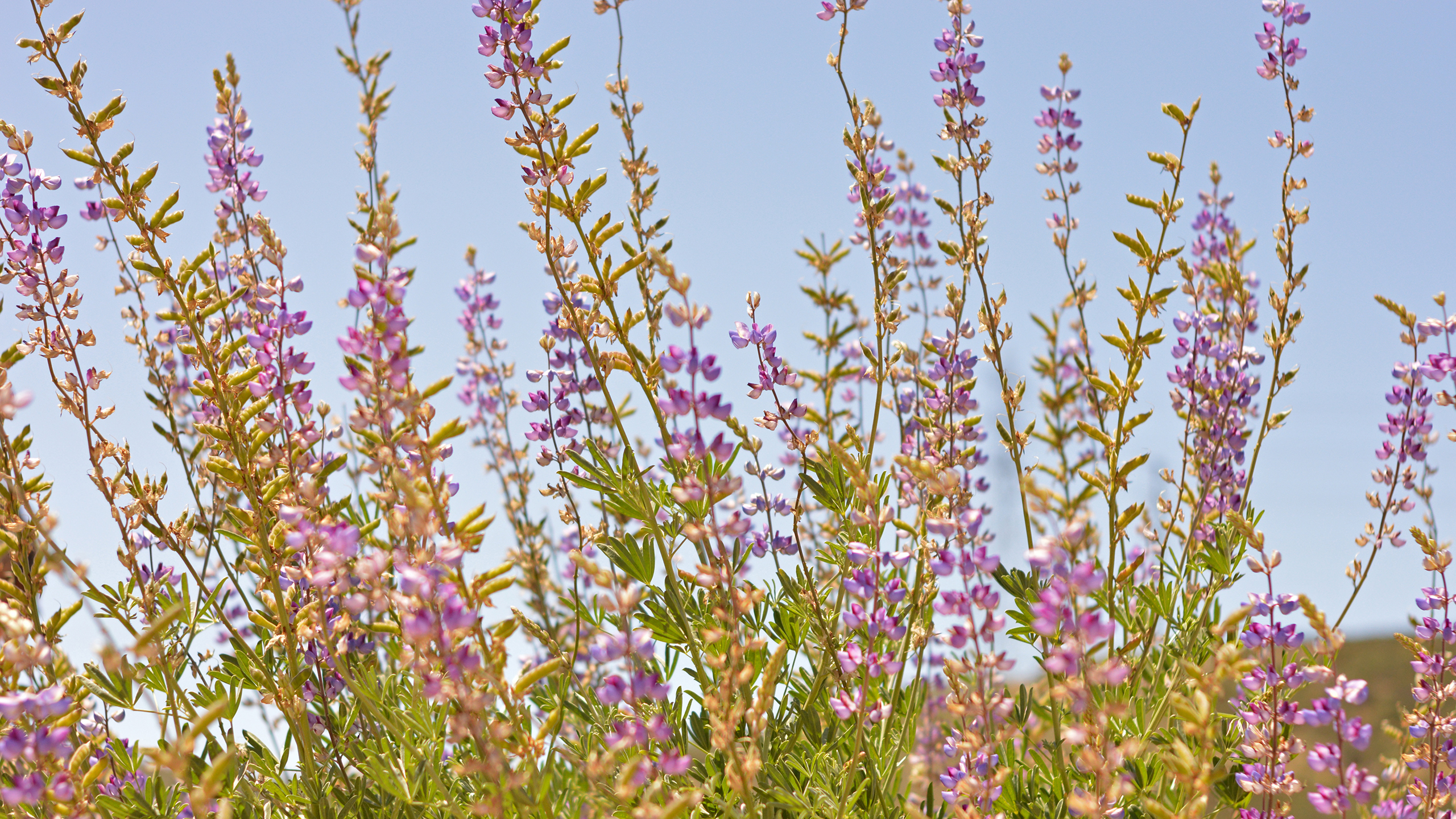
Coastal southern California has been identified as an area supporting high biological diversity (Myers et al. 2000). Among the habitat types contributing to the high diversity of species in southern California are vernal pools. Vernal pools result from an unusual combination of soil, topography, and climate, and are inhabited by a wide variety of plant and animal taxa wholly or partly restricted to such habitats. Vernal pools form in areas with 1) relatively flat topography; 2) impermeable soils such as clay near the surface; and 3)pronounced seasonal variation in rainfall. During the rainy season (November-April in southern California) water pools atop relatively impermeable soils, and remains pooled on the surface for a period of time ranging from days to weeks. During and shortly after this period of inundation, annual plants and invertebrates characteristic of vernal pools grow and reproduce, producing propagules that can withstand a long period of desiccation. The pools and underlying soil soon dry up, and the seeds, spores, cysts, and eggs of vernal pool flora and fauna remain dormant in the soil until the next rainy season. The annual period of inundation inhibits growth of upland plants in vernal pool areas, conversely the annual period of desiccation precludes the development of a typical community of marsh plants and animals. Therefore a particular group of species tolerant of the pattern of seasonal inundation and desiccation has evolved to occupy vernal pools.
Due to the rarity of vernal pools and the low dispersal capability of their characteristic biota, vernal pool animals and plants show a high degree of endemism between groups of pools. Because of this high endemism, and the specialization of vernal pool species for their unusual habitat, vernal pools contribute a disproportionately high number of species to southern California's overall biological diversity, relative to their limited area.
The rapid growth in southern California's human population and concomitant development have greatly reduced the area of vernal pools and the abundance and distribution of their unique taxa. Remaining vernal pools are threatened by development related impacts such as trash dumping, off-road vehicle travel, and invasion by exotic plant species. Several vernal pool species in southern California are listed as threatened or endangered under the Endangered Species Act. In response to the decline in extent of vernal pools
Non-native plant species are considered a threat to virtually all of the extant populations of the federally endangered Ambrosia pumila. The objective of this study was to compare the response of A. pumila among to several vegetation management techniques that included: mowing, application of Fusilade II Turf and Ornamental Herbicide (a grass-specific herbicide to remove non-native species), hand-pulling of all non-native species, and a control. This study was replicated at three different sites in San Diego and Riverside Counties (Skunk Hollow Preserve, Mission Trails Regional Park, and San Diego National Wildlife Refuge), which in turn allows us to describe management options for the full geographical range in which A. pumila occurs.
In 2002 The U. S. Geological Survey (USGS) was contracted by the Sweetwater
Authority to conduct a study examining the short-term and long-term effects of Loveland Dam
operations on the arroyo toad (Bufo californicus) below that dam in the Sweetwater River
channel. The first phase of the study was a risk assessment, which examined the short-term and
long-term effects of Loveland Dam operations on arroyo toad reproductive success and
population viability (see Madden-Smith et al. 2004). This report covers the second phase of the
study, which involved baseline surveys for arroyo toad habitat and arroyo toads below Loveland
Dam. During the 2003 arroyo toad breeding season, daytime habitat and nocturnal presence
surveys for arroyo toads were conducted at four sites along the Sweetwater River: 1) Sycuan
Peak Ecological Reserve, Sweetwater River; 2) San Diego National Wildlife Refuge, Sweetwater
River; 3) Cottonwood Golf Course along the San Diego National Wildlife Refuge border, and 4)
upper Sweetwater Reservoir. Habitat assessment included: percent vegetative cover, streambed
and bank vegetation type, substrate type, descriptions of arroyo toad habitat characteristics and
hydrologic descriptions including stream width and estimates of flow. Habitat assessment at
Sycaun Peak Ecological Reserve resulted in two reaches rated as high quality, two reaches rated
as good quality, three reaches rated as marginal quality and two reaches rated as poor quality.
Habitat assessment at San Diego National Wildlife Refuge and upper Sweetwater Reservoir
resulted in one reach of high quality habitat for each site. Habitat assessment at Cottonwood
Golf Course resulted in one reach of good quality habitat. Based on the results of the daytime
habitat assessment, nocturnal adult presence surveys were conducted at potentially suitable
arroyo toad habitat (habitat rated high or good quality). Nocturnal surveys were conducted for
six nights at each site and arroyo toads were not detected at any of the sites. Survey techniques
were in accordance with the recommended U. S. Fish and Wildlife Service (USFWS) Protocol
(USFWS1999b). For inaccessible areas, available arroyo toad abundance and distribution data
were used to fill in where current information is lacking. Management concerns (e.g., presence
of bullfrogs or other non-native predators, obstructive vegetative growth [native and non-native],
etc.) were also identified as part of the baseline surveys. Results
90-Day Report for the Wet-Season Presence/Absence Survey for Vernal Pool Brachiopods Conducted on the Shinohara Parcel within the San Diego National Wildlife Refuge (SDNWR), San Diego County, California
The purpose of this project is to address the issue of habitat connectivity and wildlife crossing State Route 94 safely in an area north of the city of Jamul. It is little to no surprise that road and highway developments have a large impact on natural habitats and wildlife. State Route 94 is no exception, dividing the north side from the south side of the San Diego National Wildlife Refuge. Too often, animals attempt to cross the highway and end up endangering not only themselves but human motorist as well. The fundamental basis of this project includes designing a culvert that will ideally serve all different species in the area, effectively decreasing the mortality rate of wildlife and increasing safety for motorist. This project will also include widening of SR-94 to have a LOS A by determining how many more lanes will be needed to service traffic flow in future years. Additional considerations are the local watershed welfare and major pipelines from the Otay Water District pump station that will need to be avoided or redirected at the discretion of the water consultant. While all this is underway, construction management will address construction access, budgeting, and phasing of the project as to not congest traffic during working hours. The wildlife-crossing project must also keep in mind to minimize environmental impact, especially due to the nature of the wildlife refuge.
This review prioritizes infrastructure improvements of 35 existing undercrossings inspected by wildlife experts in the field along 14.6 miles of SR-94 where the highway bisects conserved lands—particularly between the San Diego National Wildlife Refuge (SDNWR), where a box culvert has been designed specifically for this undercrossing, between Rancho Jamul Ecological Reserve (RJER) and Hollenbeck Canyon Wildlife Area (HCWA), and between Bureau of Land Management (BLM) lands and the Lawrence and Barbara Daley Preserve (LB Daley). In total, SR-94 crosses >10 miles of conserved lands with only three bridges—at the Sweetwater River, Dulzura Creek, and Campus Grove bridge in Dulzura. Following is a summary of improvements recommended for existing undercrossings and proposed new undercrossings, by segment, presented in this document.